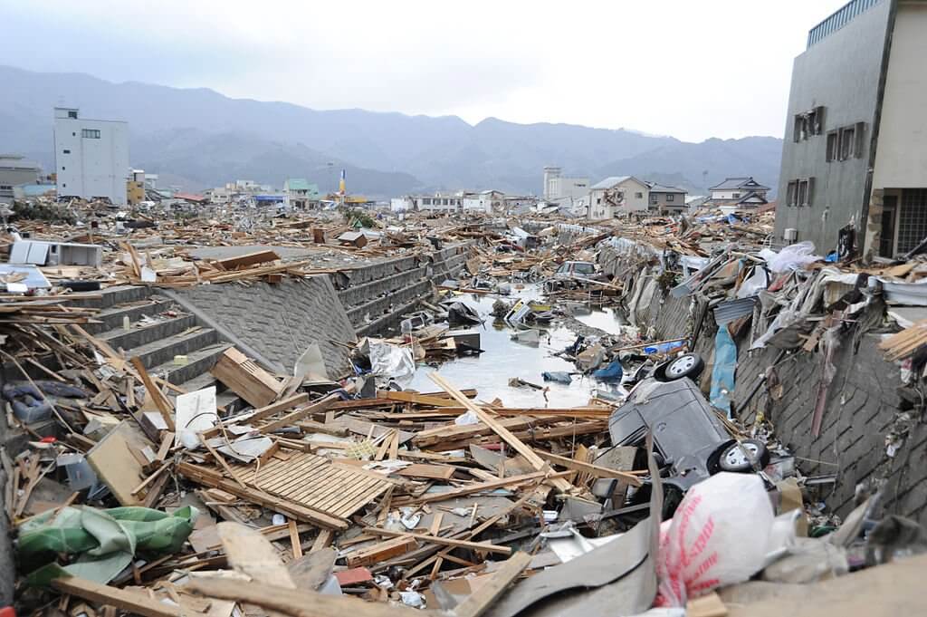
ใน ep นี้ เราจะสมมติตัวเองเป็น นักผังเมืองทางด้านความปลอดภัย ในประเทศญี่ปุ่น เราจะมาวิเคราะห์กันว่าพื้นที่ไหนของญี่ปุ่น ต้องการเสริมกำลังป้องกันสาธาณภัยทางด้านแผ่นดินไหวเป็นพิเศษ เสริมโครงสร้างอาคารป้องกันแผ่นดินไหวเป็นพิเศษ

Vehicles and debris line a canal in the downtown area of Ofunato, Japan, following a 9.0 magnitude earthquake and subsequent tsunami. Credit https://commons.wikimedia.org/wiki/File:US_Navy_110315-N-2653B-144_Vehicles_and_debris_line_a_canal_in_the_downtown_area_of_Ofunato,_Japan.jpg

Geospatial Analysis

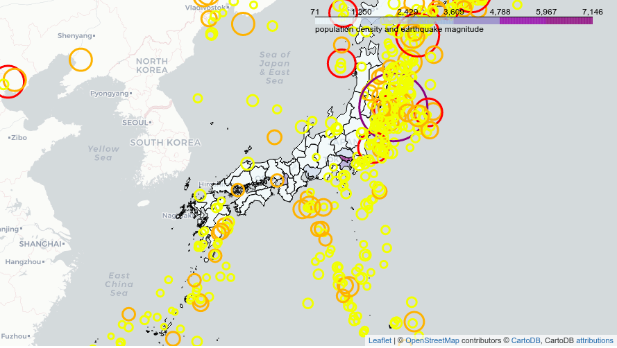
เราจะวิเคราะห์ดูว่า ในบริเวณไหนของญี่ปุ่น ที่เกิดแผ่นดินไหวบ่อย ๆ และมีประชากรอยู่อาศัยหนาแน่น ความสัมพันธ์กับระยะห่างไปยังรอยต่อเปลือกโลกภาคพื้นทวีป Plate Boundary

visualize earthquake depth and plate boundaries

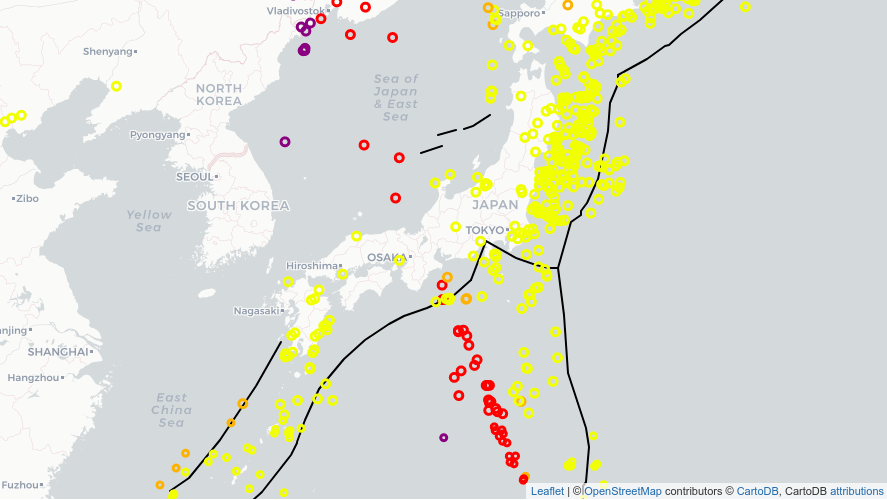
ในภาคเหนือของประเทศญี่ปุ่น ปรากฎว่าแผ่นดินไหวที่ใกล้กับรอยต่อเปลือกโลกภาคพื้นทวีป มักจะไม่ค่อยลึก แต่แผ่นดินไหวที่ห่างจากรอยต่อออกไป จะลึกกว่า

รูปแบบการเกิดแผ่นดินไหวแบบนี้ สามารถพบได้ในที่อื่น ๆ อีก เช่น ชายฝั่งตะวันตกของอเมริกาใต้ แต่ก็ไม่ได้พบในทุกที่เสมอไป เช่น จีน มองโกลเลีย และรัสเซีย

เรามาเริ่มกันเลยดีกว่า

Open In Colab

แชร์ให้เพื่อน:

Surapong Kanoktipsatharporn on FacebookSurapong Kanoktipsatharporn on LinkedinSurapong Kanoktipsatharporn on Rss
Surapong Kanoktipsatharporn
Solutions Architect at Bua Labs
The ultimate test of your knowledge is your capacity to convey it to another.

Published by Surapong Kanoktipsatharporn

The ultimate test of your knowledge is your capacity to convey it to another.